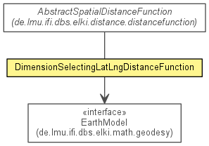

public class DimensionSelectingLatLngDistanceFunction
extends AbstractSpatialDistanceFunction
EarthModel.distanceDeg(double, double, double, double)).
This implementation allows index accelerated queries using R*-trees (by
providing a point-to-rectangle minimum distance), as published in:
Erich Schubert, Arthur Zimek and Hans-Peter Kriegel
Geodetic Distance Queries on R-Trees for Indexing Geographic Data
Advances in Spatial and Temporal Databases - 13th International Symposium,
SSTD 2013, Munich, Germany
| Modifier and Type | Class and Description |
|---|---|
static class |
DimensionSelectingLatLngDistanceFunction.Parameterizer
Parameterization class.
|
| Modifier and Type | Field and Description |
|---|---|
(package private) int |
dimlat
Latitude dimension.
|
(package private) int |
dimlng
Longitude dimension.
|
(package private) EarthModel |
model
Earth model used.
|
| Constructor and Description |
|---|
DimensionSelectingLatLngDistanceFunction(int dimlat,
                                        int dimlng,
                                        EarthModel model)
Constructor.
|
| Modifier and Type | Method and Description |
|---|---|
double |
distance(NumberVector o1,
        NumberVector o2)
Computes the distance between two given DatabaseObjects according to this
distance function.
|
boolean |
equals(Object obj) |
SimpleTypeInformation<? super NumberVector> |
getInputTypeRestriction()
Get the input data type of the function.
|
int |
hashCode() |
double |
minDist(SpatialComparable mbr1,
       SpatialComparable mbr2)
Computes the distance between the two given MBRs according to this distance
function.
|
instantiatedimensionality, dimensionality, dimensionality, dimensionalityisMetric, isSymmetricclone, finalize, getClass, notify, notifyAll, toString, wait, wait, waitisMetric, isSymmetricfinal int dimlat
final int dimlng
final EarthModel model
public DimensionSelectingLatLngDistanceFunction(int dimlat,
                                        int dimlng,
                                        EarthModel model)
dimlat - Dimension storing the latitudedimlng - Dimension storing the longitudemodel - Earth modelpublic double distance(NumberVector o1, NumberVector o2)
PrimitiveDistanceFunctiondistance in interface NumberVectorDistanceFunction<NumberVector>distance in interface PrimitiveDistanceFunction<NumberVector>distance in class AbstractPrimitiveDistanceFunction<NumberVector>o1 - first DatabaseObjecto2 - second DatabaseObject@Reference(authors="Erich Schubert, Arthur Zimek and Hans-Peter Kriegel", title="Geodetic Distance Queries on R-Trees for Indexing Geographic Data", booktitle="Advances in Spatial and Temporal Databases - 13th International Symposium, SSTD 2013, Munich, Germany") public double minDist(SpatialComparable mbr1, SpatialComparable mbr2)
SpatialPrimitiveDistanceFunctionmbr1 - the first MBR objectmbr2 - the second MBR objectpublic SimpleTypeInformation<? super NumberVector> getInputTypeRestriction()
DistanceFunctiongetInputTypeRestriction in interface DistanceFunction<NumberVector>getInputTypeRestriction in interface PrimitiveDistanceFunction<NumberVector>getInputTypeRestriction in class AbstractNumberVectorDistanceFunctionCopyright © 2015 ELKI Development Team, Lehr- und Forschungseinheit für Datenbanksysteme, Ludwig-Maximilians-Universität München. License information.