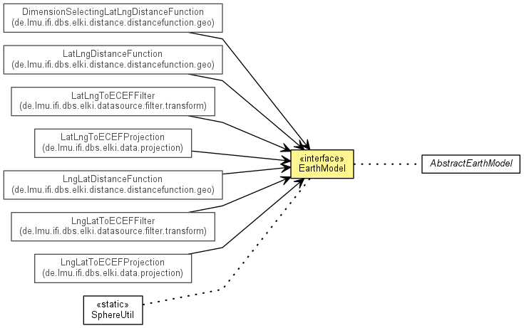
public interface EarthModel
| Modifier and Type | Field and Description |
|---|---|
static OptionID |
MODEL_ID
Parameter to choose the earth model to use.
|
| Modifier and Type | Method and Description |
|---|---|
double |
distanceDeg(double lat1,
           double lng1,
           double lat2,
           double lng2)
Compute the geodetic distance between two surface coordinates.
|
double |
distanceRad(double lat1,
           double lng1,
           double lat2,
           double lng2)
Compute the geodetic distance between two surface coordinates.
|
double |
ecefToLatDeg(double x,
            double y,
            double z)
Convert a 3D coordinate pair to the corresponding latitude.
|
double[] |
ecefToLatLngDegHeight(double x,
                     double y,
                     double z)
Convert a 3D coordinate pair to the corresponding latitude, longitude and
height.
|
double[] |
ecefToLatLngRadHeight(double x,
                     double y,
                     double z)
Convert a 3D coordinate pair to the corresponding latitude, longitude and
height.
|
double |
ecefToLatRad(double x,
            double y,
            double z)
Convert a 3D coordinate pair to the corresponding latitude.
|
double |
ecefToLngDeg(double x,
            double y)
Convert a 3D coordinate pair to the corresponding longitude.
|
double |
ecefToLngRad(double x,
            double y)
Convert a 3D coordinate pair to the corresponding longitude.
|
double |
getEquatorialRadius()
Equatorial radius
|
double |
getPolarDistance()
Polar distance.
|
double[] |
latLngDegToECEF(double lat,
               double lng)
Map a degree latitude, longitude pair to 3D X-Y-Z coordinates, using a
spherical earth model.
|
double[] |
latLngDegToECEF(double lat,
               double lng,
               double h)
Map a degree latitude, longitude pair to 3D X-Y-Z coordinates, using a
spherical earth model.
|
double[] |
latLngRadToECEF(double lat,
               double lng)
Map a radians latitude, longitude pair to 3D X-Y-Z coordinates, using a
spherical earth model.
|
double[] |
latLngRadToECEF(double lat,
               double lng,
               double h)
Map a radians latitude, longitude pair to 3D X-Y-Z coordinates, using a
spherical earth model.
|
double |
minDistDeg(double plat,
          double plng,
          double rminlat,
          double rminlng,
          double rmaxlat,
          double rmaxlng)
Compute a lower bound for the geodetic distance point to rectangle.
|
double |
minDistRad(double plat,
          double plng,
          double rminlat,
          double rminlng,
          double rmaxlat,
          double rmaxlng)
Compute a lower bound for the geodetic distance point to rectangle.
|
static final OptionID MODEL_ID
double[] latLngDegToECEF(double lat,
                       double lng)
lat - Latitude in degreelng - Longitude in degreedouble[] latLngRadToECEF(double lat,
double lng)
lat - Latitude in radianslng - Longitude in radiansdouble[] latLngDegToECEF(double lat,
double lng,
double h)
lat - Latitude in degreelng - Longitude in degreeh - Heightdouble[] latLngRadToECEF(double lat,
double lng,
double h)
lat - Latitude in radianslng - Longitude in radiansh - Heightdouble ecefToLatDeg(double x,
double y,
double z)
x - X valuey - Y valuez - Z valuedouble ecefToLatRad(double x,
double y,
double z)
x - X valuey - Y valuez - Z valuedouble ecefToLngDeg(double x,
double y)
x - X valuey - Y valuedouble ecefToLngRad(double x,
double y)
x - X valuey - Y valuedouble[] ecefToLatLngDegHeight(double x,
double y,
double z)
ecefToLatDeg(double, double, double)
and ecefToLngDeg(double, double) instead, which has a smaller memory footprint.x - X valuey - Y valuez - Z valuedouble[] ecefToLatLngRadHeight(double x,
double y,
double z)
ecefToLatRad(double, double, double)
and ecefToLngRad(double, double) instead, which has a smaller memory footprint.x - X valuey - Y valuez - Z valuedouble distanceDeg(double lat1,
double lng1,
double lat2,
double lng2)
lat1 - Latitude of first in degrees.lng1 - Longitude of first in degrees.lat2 - Latitude of second in degrees.lng2 - Longitude of second in degrees.double distanceRad(double lat1,
double lng1,
double lat2,
double lng2)
lat1 - Latitude of first in radians.lng1 - Longitude of first in radians.lat2 - Latitude of second in radians.lng2 - Longitude of second in radians.double minDistDeg(double plat,
double plng,
double rminlat,
double rminlng,
double rmaxlat,
double rmaxlng)
plat - Latitude of point in degrees.plng - Longitude of point in degrees.rminlat - Min latitude of rectangle in degrees.rminlng - Min Longitude of rectangle in degrees.rmaxlat - Max Latitude of rectangle in degrees.rmaxlng - Max Longitude of rectangle in degrees.double minDistRad(double plat,
double plng,
double rminlat,
double rminlng,
double rmaxlat,
double rmaxlng)
plat - Latitude of point in radians.plng - Longitude of point in radians.rminlat - Min latitude of rectangle in radians.rminlng - Min Longitude of rectangle in radians.rmaxlat - Max Latitude of rectangle in radians.rmaxlng - Max Longitude of rectangle in radians.double getEquatorialRadius()
double getPolarDistance()
Copyright © 2015 ELKI Development Team, Lehr- und Forschungseinheit für Datenbanksysteme, Ludwig-Maximilians-Universität München. License information.